Where is Hurricane Erin going to hit? Projected path and everything you need to know about fastest intensifying storm in Atlantic history
-
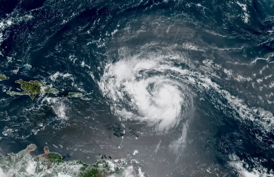 Hurricane Erin (Image via Instagram/@nwsnhc_hurricanes)
Hurricane Erin, the very first hurricane of the 2025 Atlantic season, has already set a record for one of the fastest intensifying storms in hurricane basin history. Erin was briefly at catastrophic strength (Category 5) on Saturday, but now it has weakened to Category 3. Forecasters warn the hurricane could take on varying strengths for the next few days.
Forecast models indicate Erin is expected to curve north into the western Atlantic, while remaining off the U.S. mainland, it will be close enough to cause dangerous conditions along the coast.
While the timeline is still vague, beaches in North Carolina, especially the Outer Banks, will experience high surf, rough seas, and strong rip currents by mid-week. Bermuda may feel more direct impacts later, depending on the eventual storm track.
Category 4 Hurricane #Erin passes to the north of Puerto Rico. Here are the 11 pm AST forecast Key Messages. Visit https://t.co/tW4KeGe9uJ for updates. pic.twitter.com/ISaWrmQpUn
— National Hurricane Center (@NHC_Atlantic) August 17, 2025Hurricane Erin was declared a Category 3 hurricane and had maximum sustained winds of nearly 125 mph as of early Sunday, per the National Hurricane Center (NHC). The storm was roughly 150 miles north of Puerto Rico and was moving west-northwest.
Even with the observed trend, hurricane specialists indicate that Eyewall replacement cycles may occur and allow Erin to regain some strength and increase in size. According to BBC, the Turks and Caicos Islands are still under tropical storm warning, and the southeast Bahamas are under tropical storm watch.
A look into Hurricane Erin’s category and impacts so far
Meteorologists were shocked by Hurricane Erin’s explosive intensification. In just over a day, Erin ramped up from a Category 1 hurricane packing 75 mph to a Category 5 hurricane with 160 mph winds.
According to a report by AP News, meteorologists say that the rate of intensification is likely one of the fastest in the North Atlantic, especially this early in the season. Most rapid intensification occurs later in the year when the waters are at their warmest.
Researchers attribute the event to climate change, and when ocean temperatures are warmer, it supposedly creates more available energy for hurricanes to intensify. Global temperatures are rising, and warmer air can hold more moisture and lead to heavier rainfall in storms.
1-minute #GOES19/#GOESEast Visible and Infrared images showed Hurricane #Erin as it rapidly intensified from a Category 4 to a Category 5 storm. There was an impressive amount of lightning activity within the inner eyewall of the pinhole eye. pic.twitter.com/dZZrHOvgfh
— UW-Madison CIMSS (@UWCIMSS) August 16, 2025Intense rain, fierce winds, and extensive electrical outages have already impacted Puerto Rico and the U.S. Virgin Islands. Luma Energy, which operates Puerto Rico's electrical system, reported more than 159,000 customers without power on Sunday morning.
Rainfall totals of 3 to 6 inches, with some locations receiving 8 inches, are expected across the northern Caribbean. Flash flooding and mudslides remain possible in the hilly terrain. Erin has already become the fifth named storm of the 2025 season, which forecasters expect to be very active. They expect six to ten hurricanes and up to five of those to become major storms.
TOPICS: Human Interest, The Bahamas, Bermuda, Category 5, Hurricane Erin, National Hurricane Center, North Carolina, Puerto Rico
- Christmas 2025 Nordstrom sale: 7 best holiday gifts to give your loved ones
- What happened at Hazie's, San Francisco? Couple goes viral for irrate behaviour that leads them to being kicked out of the restro
- What happened to Sammie Mosier? HCA Healthcare and more pay tribute to beloved nurse following sudden death
- “This is a family tragedy”: Marjorie Taylor Greene urges empathy after Trump refers to Rob Reiner as ‘Tortured’ and ‘Struggling’ in condolence message